

Arches National Park
Arch Canyon
Canyonlands National Park
Canyons of the Ancients NM
Cedar Mesa
Comb Ridge
Dark Canyon
Edge of the Cedars
Four Corners Monument
Glen Canyon Rec Area
Goosenecks State Park
Grand Gulch
Hovenweep NM
Manti-Lasal Forest
Moki Dugway
Monument Valley
Muley Point
Natural Bridges NM
Newspaper Rock SP
Rainbow Bridge NM
San Juan River
Valley of the Gods
White Canyon
Cedar Mesa Wilderness Study Area


Remnants of the Past
About Cedar Mesa
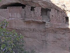
Extending from Elk Ridge to the north, the San Juan River to the south, Comb Wash to the east, and Grand Gulch to the west, the plateau known as Cedar Mesa fills an area of over 400 square miles in southeastern Utah. It is best know as the site of hundreds of deserted dwellings left behind by the ancestral Puebloan people who once made this area their home.
The plateau sits at an average of 2000 feet above the surrounding terrain, which has allowed several canyons, such as Arch, Texas, Owl, Mule, Fish, McCloyd, Road and Grand Gulch to form over the centuries as water has run off from the Manti-Lasal mountains into the San Juan River. Each of these shoot-off canyons contains ancestral Puebloan cliff dwellings.
To the southeast is found a "miniature Monument Valley" that has come to be known as the "Valley of the Gods." Legend holds that these pillars and monoliths are ancient Navajo Warriors frozen in time.
To the northwest are found the famous bridges of Natural Bridges National Monument. The fastest way from the Goosenecks State Park to Natural Bridges or vice versa is up the Moki Dugway, a gravel road that criss-crosses down the face of Cedar Mesa's southern edge.
From the top of Salvation Knoll along highway 95 you can get a stunning view of Cedar Mesa.
