

Canyons of the Ancients NM
Dark Canyon
Edge of the Cedars
Four Corners Monument
Glen Canyon Rec Area
Goosenecks State Park
Grand Gulch
Hovenweep NM
Manti-Lasal Forest
Moki Dugway
Monument Valley
Muley Point
Natural Bridges NM
Newspaper Rock SP
Rainbow Bridge NM
San Juan River
Valley of the Gods
White Canyon
Natural Bridges National Monument
U T A H ' S F I R S T N A T I O N A L M O N U M E N T
Sipapu | Owachomo | Horse Collar Ruin | Hiking Trails | Visitor's Center | Camping | Area Map
About the Bridges
Natural Bridges National Monument, located about 45 minutes west of Blanding, Utah, is home to three remarkable bridges carved over the years by the power of flash flood runoff water. The bridges, named Sipapu "The Place of Emergence", Kachina "Dancer", and Owachomo "Rock Mounds" stand as testaments to the awesome power of erosion. Sipapu is the second largest natural bridge in the world, second to Rainbow Bridge. A bridge forms when water cuts through the side of a thin canyon wall at at bend. Once through, the water will flow through the cutoff instead of around the bend. Evidence suggests that two additional bridges once existed nearby, but have since collapsed. For more information click here
Area Map
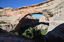
Sipapu
National Monument and Dark-Sky Park
President Theodore Roosevelt designated the bridges and the surrounding area as Utah's first National Monument on April 16th, 1908. Aside from being beautiful during the day, Natural Bridges has one of the darkest skies in the United States. In 2007, the International Dark-Sky Association designated Natural Bridges as the first International Dark-Sky Park, owed to the absence of light pollution in the area. For more information click here

Anasazi Ruins
Kachina
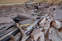
Along the hiking trails leading to the base of each bridge you can also find ruins of ancient Anasazi dwellings. The Anasazi people abandoned the sites around 700 years ago, but many are intact and well-preserved, and can be reached on foot.
Hiking Trails
Sipapu-0.6 mi, 500 ft descent
Three wooden ladders assist in the climb down. About halfway down visitor's can stop at the overlook, or continue down to the base of the bridge.
Bring water, getting back up won't be easy.
Kachina-0.75 mi, 400 ft descent
The hike to the base of Kachina is the best way to see the bridge, due to the hard-to-see view from the overlook. Hundreds of steps built on or carved into the sandstone assist in the descent.
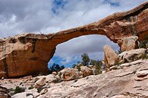
Owachomo-0.2 mi, 180 ft descent
A short and easy hike leads to the base of the thinnest of the bridges.
