Natural Bridges National Monument
UTAH'S FIRST NATIONAL MONUMENT
Horse Collar Ruin |
Hiking Trails |
Visitor's Center |
Sipapu |
Kachina |
Owachomo |
Camping |
Area Map


About Kachina
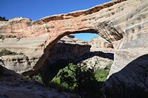
When surveyor William Douglas inspected the bridge, he found petroglyphs of figures that appeared to be dancing. It was after the petroglyphs that he named the bridge Kachina, which means "dancer" in the Hopi language.
While not as big as Sipapu, the bridge is still awe-inspiring when one stands underneath it. The bridge is the youngest geologically, with a relatively small hole, it has a very large amount of rock to be eroded away before it collapses.
Kachina formed at the junction of White Canyon and Armstrong Canyon, meaning water from both canyons contributed to its formation.
More Information
Height: 220 ft
Span: 204 ft
Thickness: 93 ft
Width: 344 ft
Trail Info
Length: 0.75 mi
Elevation change: 400 ft
The longest trail of your visit (unless you decide to visit Horse Collar Ruin) starts at the same trailhead as the Kachina Bridge overlook, leads down off the top of white canyon, then cuts back and forth across the canyon face taking the visitor down several hundred wooden and stone stairs.
The beginning of the trail drops rapidly, evening out for a few hundred feet, before the steep steps begin.
Along the way, hikers will pass a few rarely seen arches along the canyon face.
After descending numerous stairs, a ladder has been set up to provided a safe climb down a very steep segment of sandstone.
After more steps hikers will reach the bottom of the canyon. From there, the trail is rather primitive, just a path through the vegetation created by feet
following the stream bed northwest, visitors will soon come upon the relatively small (but still massive) Kachina bridge.
Before walking under the bridge, and inspection of the right side of the bridge toward the base will reveal faded petroglyphs.